


Atlas of Old Tehran
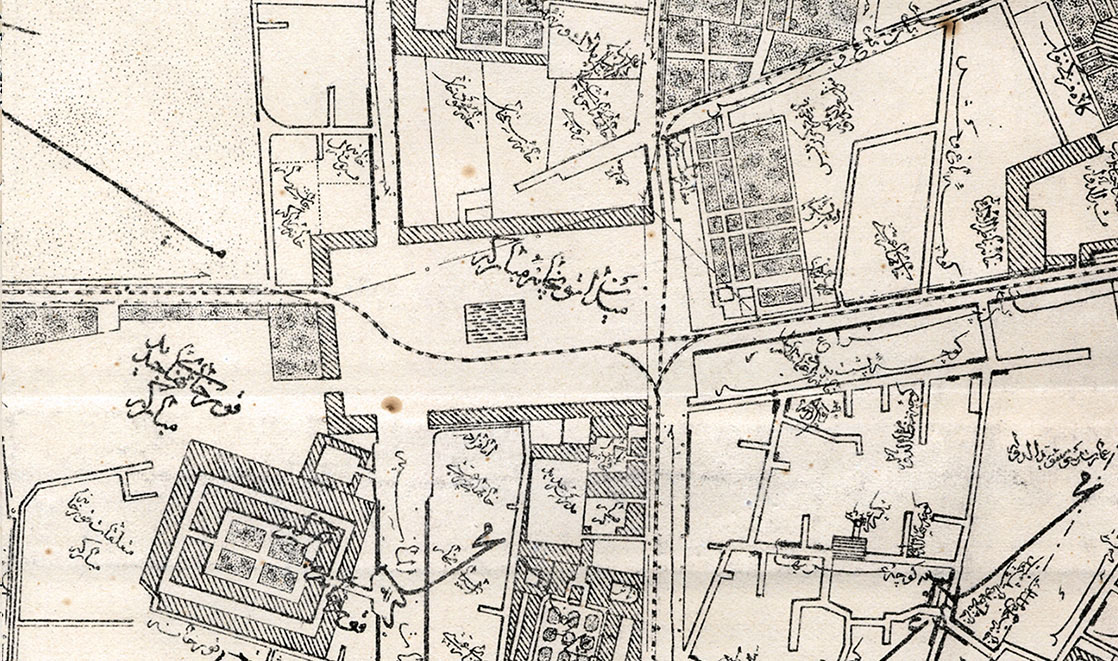
Introduces 207 Tehran maps in chronological order, of which 34 are fully presented. The maps belong to the Qajar and Pahlavi periods, and some of the maps are dated for the first time.
Alongside the maps are related images of public spaces and views of Tehran in various eras, which enhance the book's appeal to help better to understand the urban space of each period.
Approximately 8,000 location titles are named from the maps and arranged in the book listing to facilitate audience access to the desired locations.
Dr. Cyrus Alaei, a prominent researcher on maps of Iran, has written an introduction to this book.
Selected Tehran Research Festival of 1395 (2016)


Copyright © IranNegari